Social Studies Connection
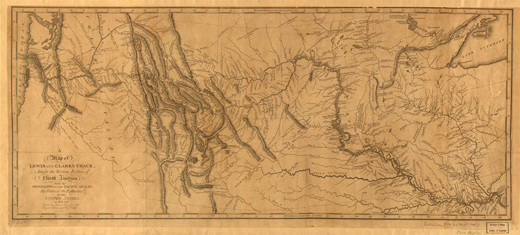
Lewis and Clark's First Published Map of Expedition Track (source: http://www.loc.gov/exhibits/treasures/images/872m.jpg) William Clark. “A Map of Lewis and Clarks Track” from History of the Expedition under the Command of Captains Lewis and Clark, to the Sources of the Missouri, thence Across the Rocky Mountains and Down the River Columbia to the Pacific Ocean, 1814. Samuel Lewis, copyist; Samuel Harrison, engraver. Engraved map. Geography and Map Division, Library of Congress (67)
"The object of your mission is to explore the Missouri river, and such principal stream of it, as, by its course and communication with the waters of the Pacific Ocean, may offer the most direct and practicable water communication across this continent, for the purposes of commerce." -President Thomas Jefferson's instructions to Meriwether Lewis
The American West: A River Runs Through It?
An Overview of the Lewis and Clark Expedition
The following lesson activity is part of a multidisciplinary unit of study on Water. The lesson consists of two parts with a strong technology emphasis. The first part is asking students to engage in inquiry activities with primary source documents. The second part is an activity involving the use of Google Maps, to emphasize how we can retrace Lewis and Clark's expedition using modern technology. We can use mapping software as a navigational tool as well as a means of publishing a summary of our journey.
The above document may be alternatively viewed here: https://docs.google.com/document/d/1EUNFyhD6Gzdo_-CpuBQsq1vNez-Fj8HBAE48QNR_eY0/pub
